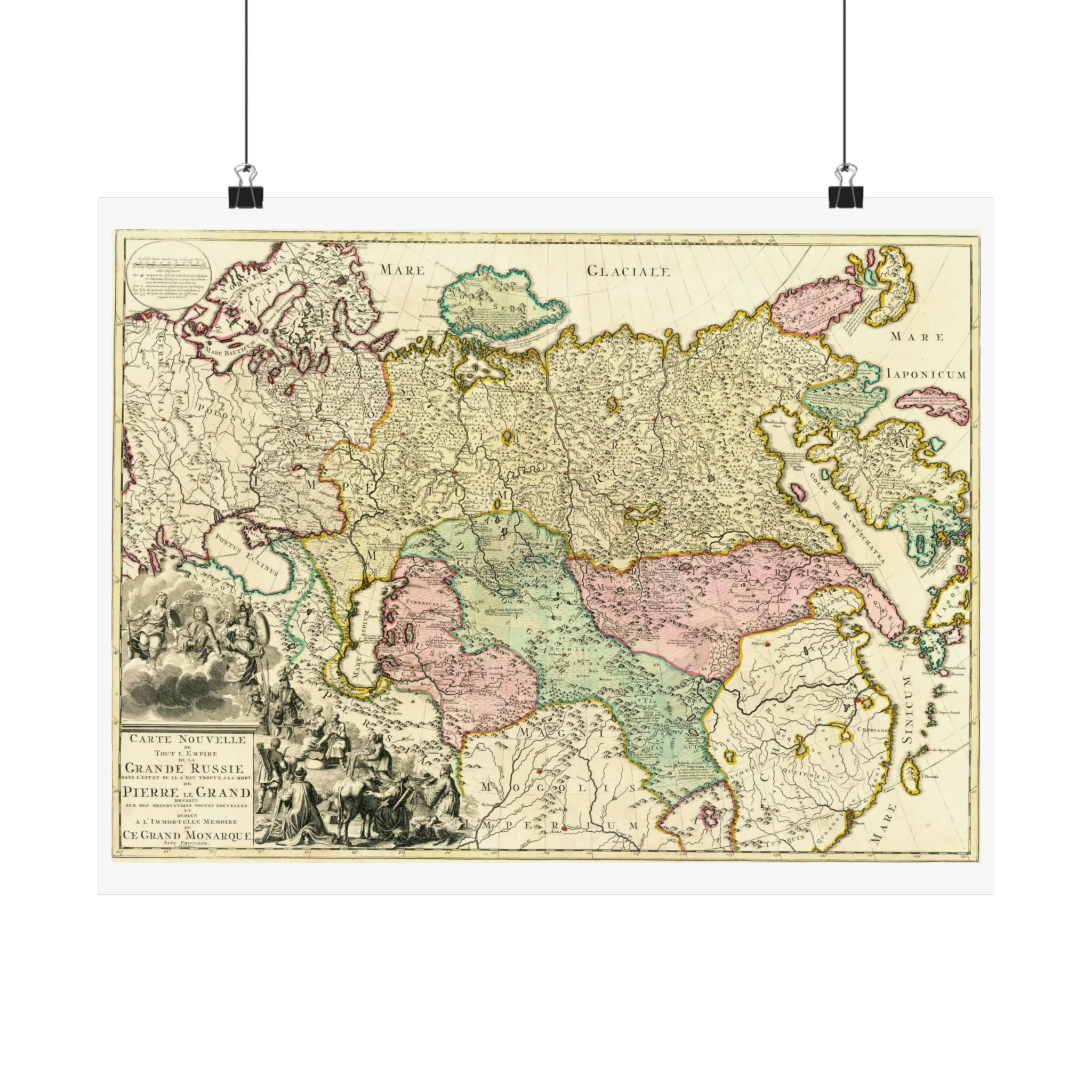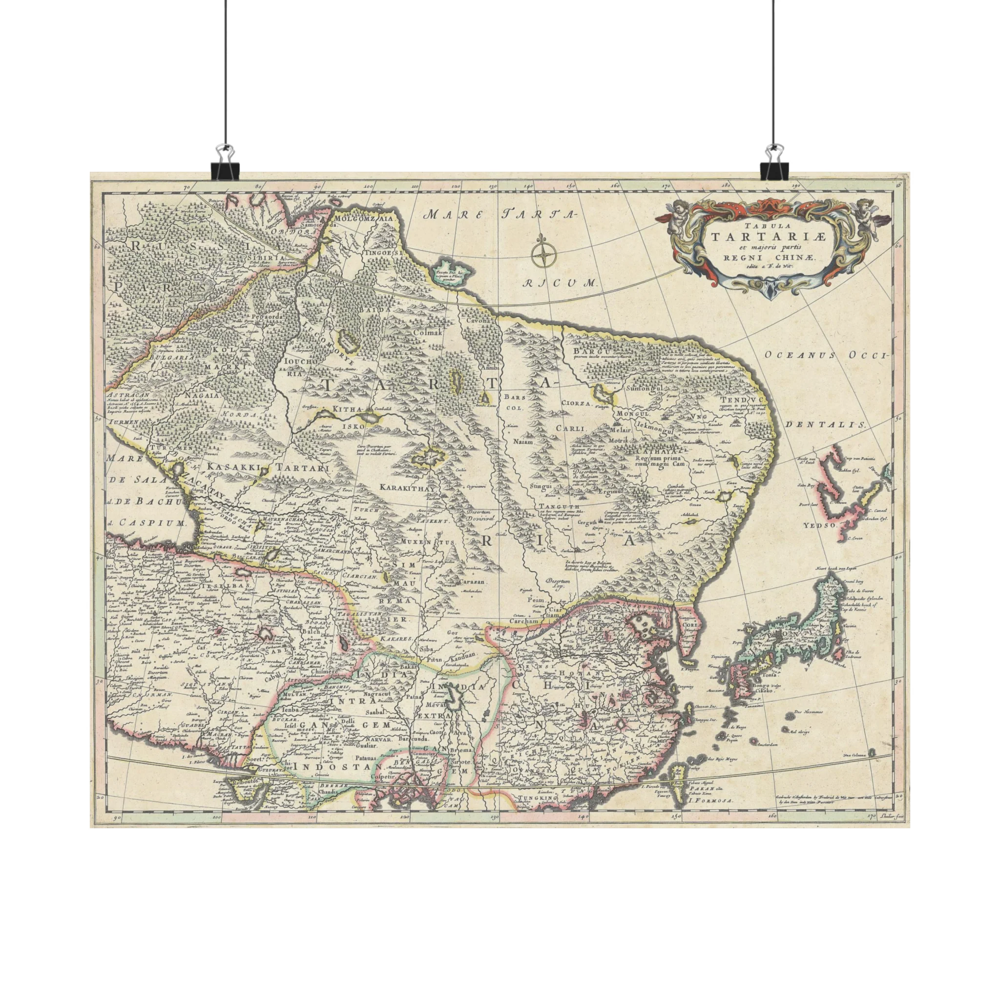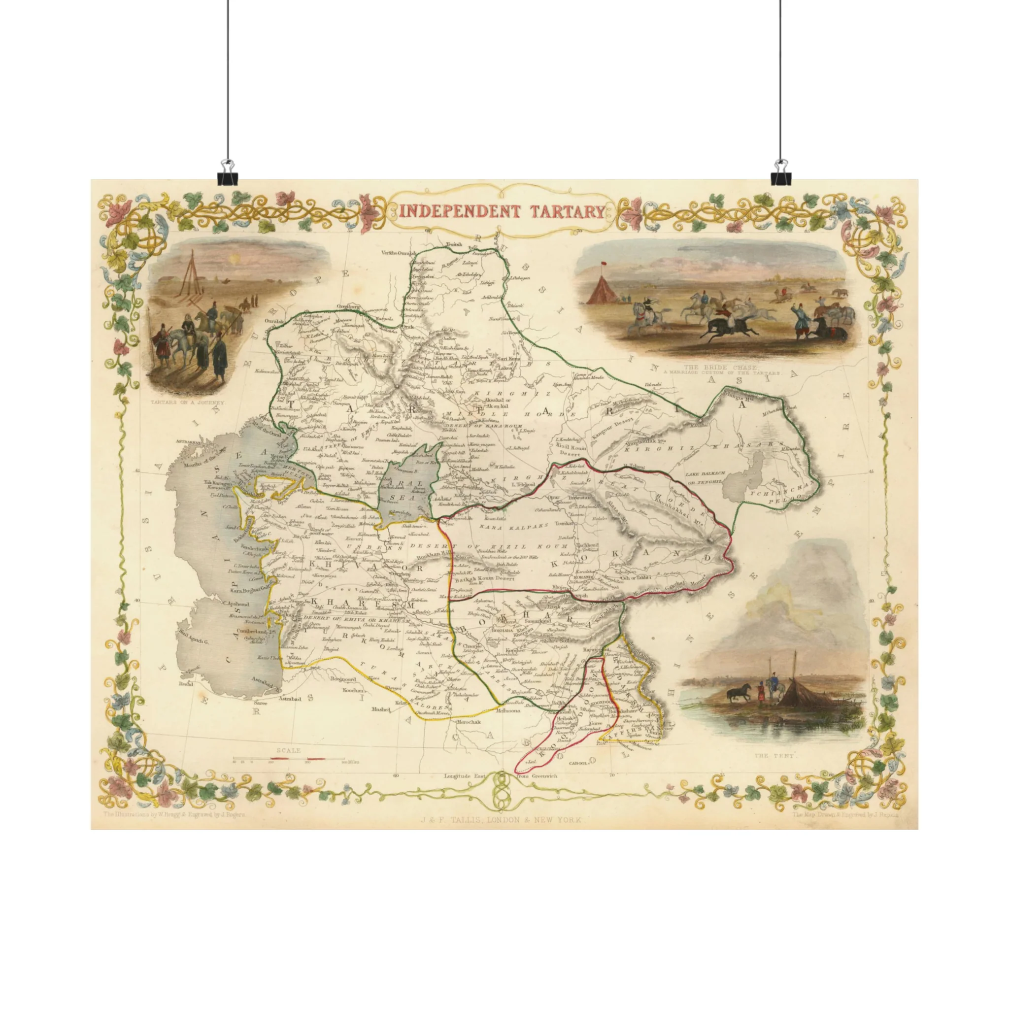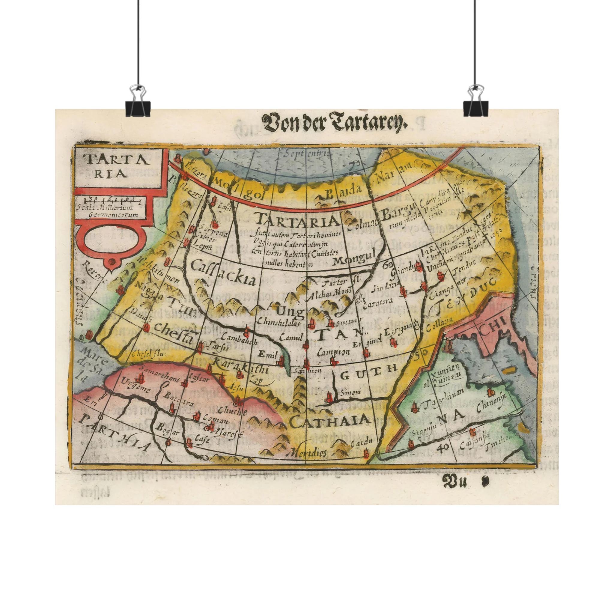
Map of Tartaria by Bertius, 16th–17th centuries
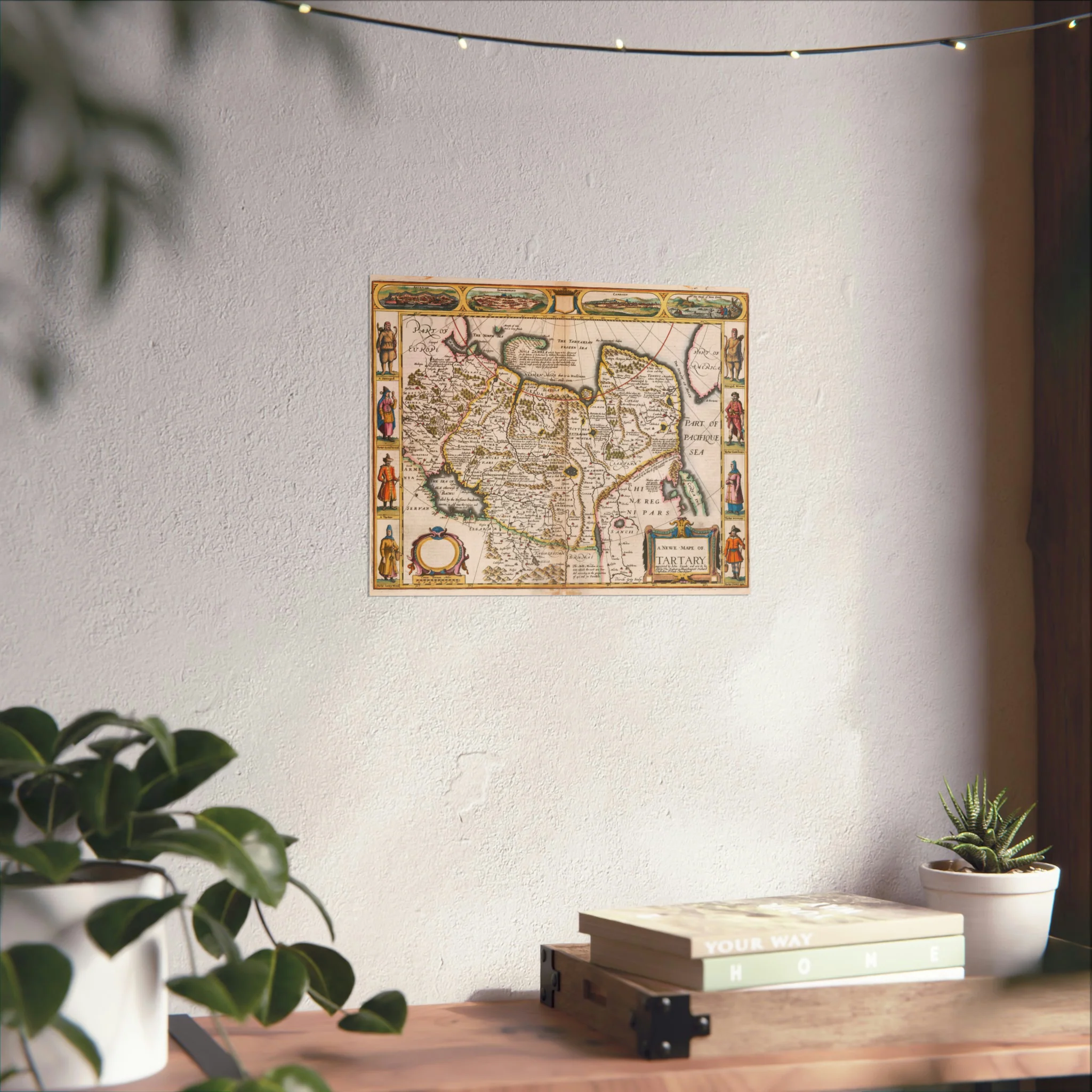
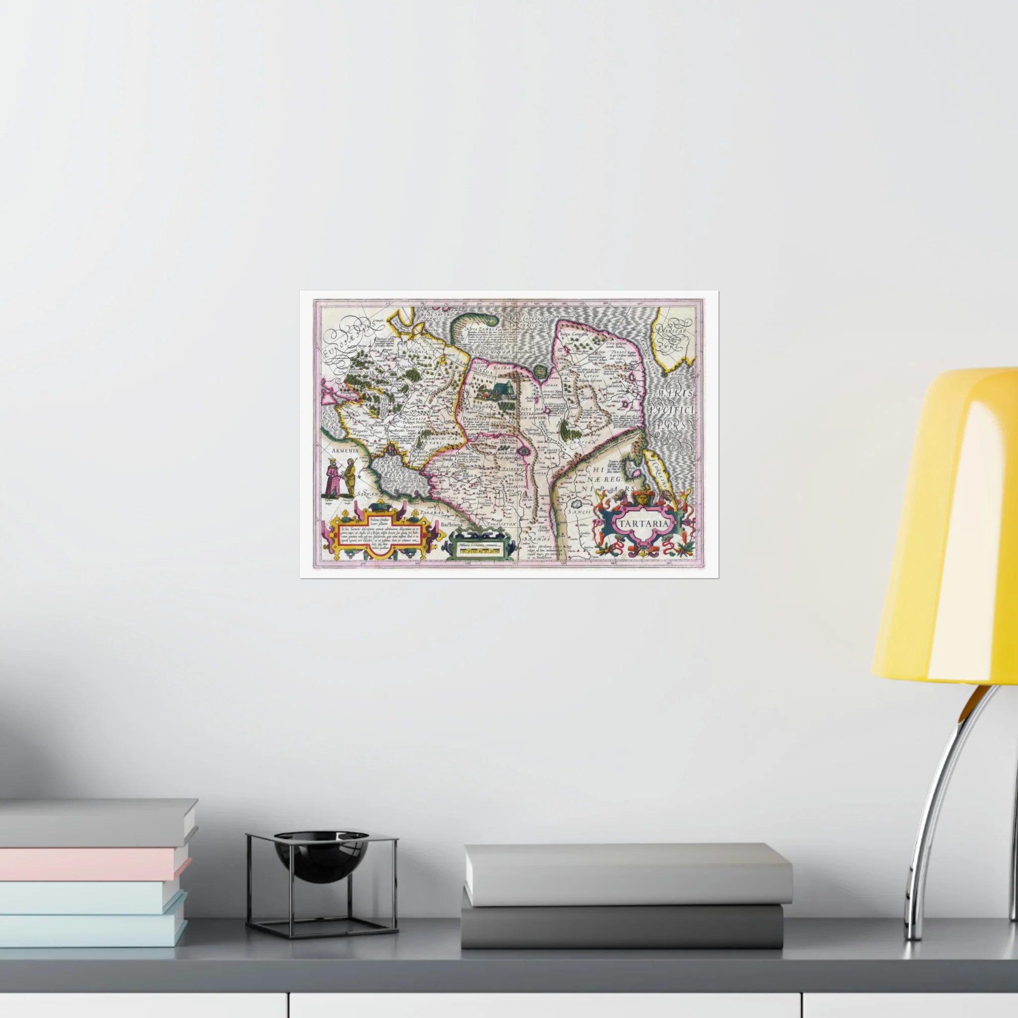
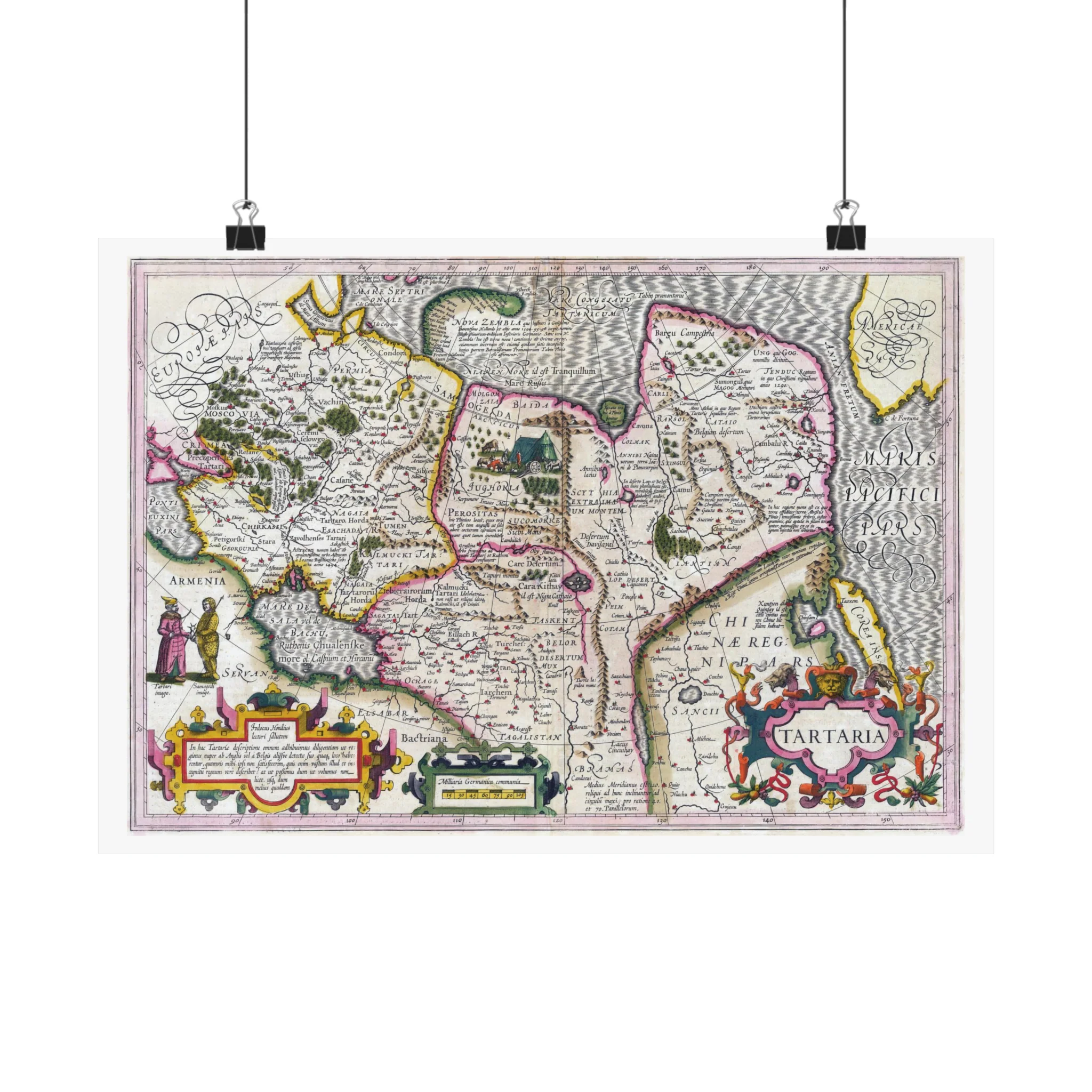
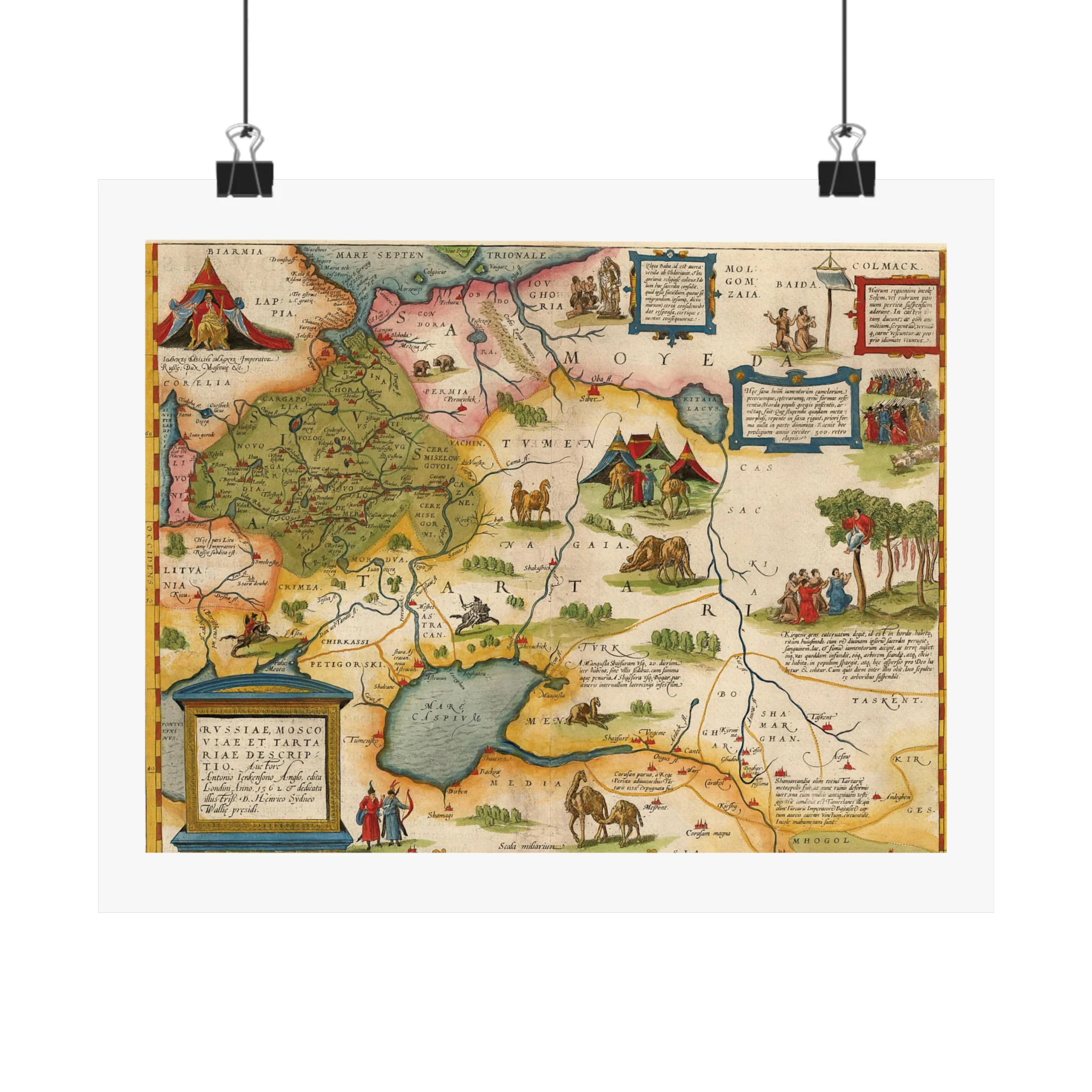
The map of Tartaria by the geographer and cartographer Petrus Bertius (1565–1629). Bertius is best known as a mapper for his version of the Geographia of Ptolemy. In this 16th or 17th century Tartaria map, China is represented with “Chi” at the right and Parthia is shown at the bottom left next to the Caspian Sea, which reads Mar de Sala.
The map of Tartaria by the geographer and cartographer Petrus Bertius (1565–1629). Bertius is best known as a mapper for his version of the Geographia of Ptolemy. In this 16th or 17th century Tartaria map, China is represented with “Chi” at the right and Parthia is shown at the bottom left next to the Caspian Sea, which reads Mar de Sala.
Original: $29.95
-70%$29.95
$8.98Description
The map of Tartaria by the geographer and cartographer Petrus Bertius (1565–1629). Bertius is best known as a mapper for his version of the Geographia of Ptolemy. In this 16th or 17th century Tartaria map, China is represented with “Chi” at the right and Parthia is shown at the bottom left next to the Caspian Sea, which reads Mar de Sala.